Project
Schuylkill Priority Lands Tool
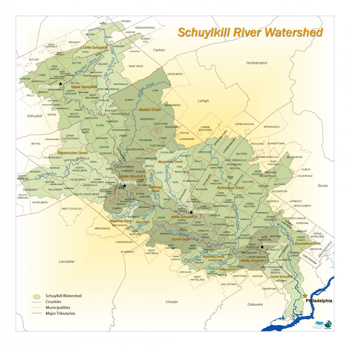
The Schuylkill Watershed Priority Lands Strategy is a model that recognizes the Land-Water Connection and identifies the highest priority lands to protect. The project uses GIS modeling to identify areas within the Schuylkill Watershed that are the most important to preserve for both ecological and drinking water source protection, further defined by development threat over the next 20 years.
The data can be downloaded here.
The process to develop the priority lands tool includes the following steps.
- Combining Natural Land's SmartConservation tool and Drinking Water Source prioritization to develop the Combined Priority Lands layer
- Then overlaying Fugure Development projections over the Combine Priority Lands to develop the Areas of Friction layer
Uses Of Model
The data from the Schuylkill Watershed Priority Lands Strategy is designed to be used for a variety of purposes that will result in protection of resources. For example, the Strategy can be used for:
- Updating county or municipal open space plans
- Rationale in grant proposals for acquisitions or easements
- During subdivision and site plan review, especially with conservation subdivisions
- Garnering support for a dedicated open space tax or bond
- Upgrading stream status to High or Exceptional Value
- Support for environmental protection ordinances
- Limiting impervious coverage in combined high resource protection areas & to promote stormwater Best Management Practices
- Promoting good stewardship of Combined Priority Lands
- Integrate local priorities to identify community conservation lands
Information
Work Group: Watershed Land Protection
Source of Funding: Pennsylvania Department of Environmental Protection
Date of Completion: 2007
Leading Organization: Delaware Valley Regional Planning Commission, Natural Lands, Philadelphia Water Department
Related Documents
| Name | Upload Date | Download | View |
|---|---|---|---|
Schuylkill Priority Lands - Areas of FrictionCombined Schuylkill priority lands and future development projections from the 2007 Schuylkill Priority Lands Tool. |
January 2, 2018 | Download | View |
Schuylkill Priority LandsCombined SmartConservation and Drinking Water Source prioritizations from the 2007 Schuylkill Priority Lands Tool. |
January 2, 2018 | Download | View |
Schuylkill Priority Lands - SmartConservationSmartConservation Model for the Schuylkill River Watershed developed by Natural Lands. |
January 2, 2018 | Download | View |
Schuylkill Priority Lands - Drinking Water Source PrioritizationMap of Drinking Water Source Prioritization in the Schuylkill River Watershed developed by Philadelphia Water Department |
January 2, 2018 | Download | View |
Schuylkill Priority Lands - Future Development ProjectionsFuture Development Projections in the Schuylkill River Watershed developed by Delaware Valley Regional Planning Commission. Includes DVRPC Regional Growth Model, Berks County Growth Model, and Schuylkill County Growth Model. |
January 2, 2018 | Download | View |
About Us
The Schuylkill Action Network (SAN) is a collaborative network of over 300 partner organizations working together to improve water resources in the Schuylkill River watershed. With "action" as SAN’s middle name, SAN partners have been working since 2003 to implement best practices across the Schuylkill River Watershed.
Downloadable Map